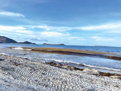
In its monitoring and forecast bulletin for the stranding of pelagic sargassum for the Northern Islands communicated on April 2, 2024, Météo France places the risk level at medium for the territories of Saint-Martin and Saint-Barthélemy.
Despite the presence of clouds making detection difficult on satellite images from last weekend, Météo France noted large concentrations of sargassum to the east and north-east of Tobago, as well as to the south and east of Barbados. Filaments are also detected closer to the islands of Saint-Martin and Saint-Barthélemy, scattered throughout the near Atlantic and the open sea, often caught in meanders due to numerous gyres (gigantic swirls of ocean water formed by a set of marine currents) in the Antilles Current. Near our islands, arrivals are expected in a northeast flow. Satellite images from March 31 and April 1 provide a good view of the surroundings, confirming the presence of a large gyre, at this time, off the northeast of the Northern Islands, a little over 100 kilometers away. The latter reorients rafts in small successive waves in a dominant northeast flow. Sargassum arrivals will follow one another in small waves until this weekend, since Tuesday for Saint-Barthélemy and the day before yesterday for Saint-Martin. It is especially the coasts to the east and north of the islands which are under threat from sargassum seaweed strandings. For the trend of the next two weeks, the risk of grounding remains relevant. Currently, the source of most arrivals for the Northern Islands is in the offshore east of the two archipelagos. The Atlantic being very busy, sargassum will continue to arrive during the next two months for the Antilles. In Guyana, the latest detections show rafts coming from the equatorial zone, feeding should therefore continue. _VX
534 total views


No comments